
Benthic Habitat Mapping
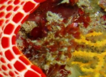
The seafloor is a highly diverse environment containing a range of benthic habitats including coral & algal reefs, seagrass meadows and bare sands & muds. Many benthic environments in coastal areas contain a combination of these habitats, often in complex mosaics, and provide food and shelter for diverse assemblages of marine organisms including many commercially significant species. The complexity of benthic habitats tends to reflect the extent of marine biodiversity.
 Consequently, they are important foci for research, monitoring and the management of ecosystem health. Such management requires firstly, that these habitats are identified and, ideally, that their spatial distributions mapped with accuracy.
Ocean Vision undertakes the production of high-quality benthic habitat maps for clients to assist them in the management of marine ecosystems.
Please read below for further information, and do not hesitate to contact us regarding our habitat mapping services.
Remote Sensing Data and Analysis
We utilise a wide range of remotely sensed data sources and classification techniques to map a diverse range of benthic habitats in marine waters, including:
- Multispectral satellite imagery (e.g. Quickbird, IKONOS, Landsat),
- Hyperspectral imagery (Hymap),
- Aerial photography, and
- Digital bathymetry
Ocean Vision consultants are highly experienced in the application of a range of standard scientifically appropriate classification algorithms, as well as specifically designed techniques for different types of imagery. We also develop robust ground validation schemes to generate field data that can be used as part of the classification process as well as in the final accuracy assessment of the resultant maps.
Aquatic Ecology
Ocean Vision’s consultants have extensive experience with the range of remote sensing applications used within the habitat mapping field. However, we are also marine and estuarine ecologists, having formal training in aquatic science.
We believe that such training provides an essential basis for understanding the most appropriate spatial and spectral scales by which an area should be mapped, and enables the selection of the most appropriate data types & methods of classification. This background is also key to enabling the selection of sampling schemes for the collection of ground validation data that provide the most appropriate spatial coverage and taxonomic / biotic resolution.
We believe that a deep understanding of the ecology of different aquatic environments is an essential ingredient for accurate habitat mapping.
Ground Validation
Ocean Vision recommends that ground validation data is used in both the classification and accuracy assessment processes of any habitat mapping project. It is thus crucial that the size and geolocation of each ground validation sample is relevant for the spatial resolution of the map being developed. Furthermore, it is important that the data recorded for each sample is of an appropriate taxonomic / biotic level and that such levels are consistent across the ground validation area.
We specialise in the selection of sampling schemes for the collection of ground validation data, and believe that the quantity & quality of ground validation data collected in the field is crucial to both the accuracy & reliability of any habitat map.
Software Tools
Ocean Vision collaborates with the research community, government organisations such as the Department of Environment and commercial organisations in the development of rigorous sampling schemes and software tools that enable the cost-effect collection, analysis and management of habitat mapping data.
Please refer to our EcoPAASComing soon... software tool for more information.